

iBuildMapAR app for iPhone and iPad
Developer: Robert Atherton
First release : 06 May 2015
App size: 19.9 Mb
iBuildMapAR is a tool to create, manipulate and share geographic data.
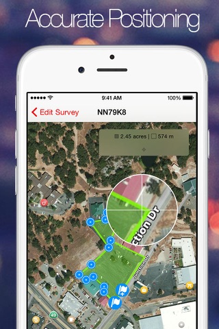
Maps can be annotated with lines, polygons, cordons, markers and overlay images, with the app performing length and area calculations.
It is for anybody who needs to use satellite imagery, or their location, to map out areas of ground and add markers.
Features at a glance:
+ Draw straight onto a satellite image and move markers with accuracy
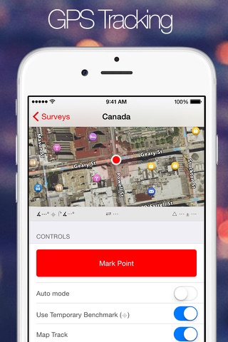
+ Record your location and take photographs
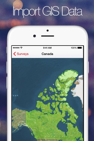
+ Import data and use in your plans
+ Calculate area and distance of surveys and plans
+ Import unlimited amounts of geographic data
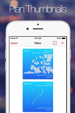
+ Create up to 5 active plans containing up to 15 surveys each. Remove this limit with an in app purchase
+ Collaborate with others and simultaneously work on the same plan
+ Chat with others working on the same plan
Extra Features unlocked with in app purchases:
+ Create an unlimited amount of plans each containing unlimited surveys
+ Export plans via AirDrop, email and social media in any of the supported file formats
Plans and maps can be created by drawing straight onto the map or marked using the devices GPS capability. Plans can also be built up by importing data from GeoJSON, GPX or KML files from a variety of online sources. Files can be downloaded and opened in the app. Therefore the app also serves as a viewer for these file types.
When drawing or marking features temporary benchmarks can be set. These can be used in any survey to make distance and bearing calculations and determine where to position marker points. Once created, surveys can be geometrically tidied up.
For recording real locations the app also includes auto-mode. Once auto-mode is started the screen can be locked to save battery life and the app records your location as you move. This way huge areas can be mapped out on foot or in vehicles.
Photographs of the area can be taken and embedded within the plan. These photos are recorded with their location and heading information. They are then included along with the plan or they can be exported to the device camera roll.
Complex or commonly used plans can be saved into layer collections and reused to make creating large, complex custom maps easy and quick.
Plans can be shared device to device or with an in app purchase they can be exported via AirDrop, email or social media. The app supports a variety of open source file types such as GeoJSON, GPX and KML. Plans can also be exported in the native file format to retain all the plan data.
Locations are displayed with their coordinates in WGS84 format and w3w addressing format.
Disclaimer:
iBuildMapAR uses a background mode to continue to map out surveys when the user selects auto-mode and the screen is locked.
Not all features in iBuildMapAR can be represented in the KML/GeoJSON/GPX format so the app converts the data so that the KML/GeoJSON/GPX resembles the original data as closely as possible.
iBuildMap supports the simplestyle-spec for styling compatibility with other common online systems
An account for iBuildMap.com can be created within the App, which is required to upload plans.
An account with a XMPP server is required to make use of collaboration and chat feature. Existing buddies for the account will be shown in the app. New buddies can be added by scanning the code in the app.
Please note
"Continued use of GPS running in the background can dramatically decrease battery life."